Walking

There is no better way of exploring Annascaul than on foot. With so many walking and hiking trails available, you are sure to find the perfect option.  Click on the map below to view the Annascaul walking trails.
Take part in the weekly Inch Beach parkrun every Saturday morning at 9.30am, open to all ages and abilities visit us on Facebook or register here. Why not sign up for the Inch Beach half marathon & 10k run/walk/jog/beach wheelchair, phone: 087 6970311 or visit us on Facebook to find out more. You can also register for the event here.
Meelin Hill - The three peaks of Annascaul

Enjoy walking the three peaks of the Brackloon and the magnificent views of the Slieve Mish Mountains, the Com Dubh river system, majestic Dingle Bay and the world renowned Inch beach and bay. There is a good article here and additional photos also known as the Brackloon walk. Dont forget to  have a coffee in Annascaul afterwards. There is a great variety of places to choose  from but if you want a good lunch in Annascaul then  Annascaul Cafe and Pottery in the middle of the village is one strong recommendation. 

Start: Walking information board Annascaul

Distance:  7.5 Km.

Rating: Moderate

Terrain: Road/Hill

Time: 2.5 hours

The Stage

This walk takes the walk/cycle track on the N86 from the Endurance Monument at ‘the Stage’ which was also the old Mail Coach/Dingle Train stop.  Then a scenic glen walk to Inch beach and returning over the Maum road giving a bird’s eye view of Annascaul village. This is a great walks and what better way to  take a  break then to lunch at Annascaul at many of the cafes there. One such cafe in Annascaul is situated in the middle of the village oppoisite Hanifins Bar. 

Start: Endurance Monument on N 86

Distance:  10.5 Km.

Rating: Easy

Terrain: Road/Trail

Time: 4 hours

Maumlaur Ridge

This is a challenging ridge walk with seven peaks and a sharp ascent and decent. The walk affords great views of Dingle Bay, the Slieve Mish Mountains, the McGuillycuddy Reeks and Tralee Bay.

Start: Maumlaur Exit on the N86.

Distance:  10.5 Km.

Rating: Difficult

Terrain: Trail/Hill

Time: 5 hours

Dingle Way

This is the second stage of the Dingle Way beginning at Camp village, through the wild beauty of the Slieve peat bogs, along the foothill overlooking Inch beach and finishing with a welcoming scenic decent into Annascaul village.

Start: Camp Church

Distance:  18 Km.

Rating: Easy

Terrain: Road/Trail

Time: 5 hours

Tom Crean Trail

This walk begins at the Tom Crean Garden walking to the old Coast Guard Station at Minard Cove, his birthplace at Gortacurrane, his final resting place at Ballinacourty Gravevard and his pub ‘The South Pole Inn’. The walk is a true homage to our most enduring polar explorer.

Start: Tom Crean Garden

Distance:  16.5 Km.

Rating: Easy

Terrain: Road

Time: 5 hours

Tom Crean Walk

This walk begins at the Tom Crean Garden and goes directly to his birthplace at Gortacurrane then to his final resting place at Ballinacourty Gravevard and his pub ‘The South Pole Inn’. A lovely tribute walk to our most enduring polar explorer.

Start: Tom Crean Garden

Distance: 5 Km.

Rating: Easy

Terrain: Road

Time: 2 hours

Acres Hill

This walk is a loop of Acres hill starting at Minard Cove on to the overlooking the storm beach at Minard to view Dingle bay in all its majesty and a clear view to Glenbeigh and the Scellig rock. Round the heather and gorse ridge to return to the magnificent testament to nature of the Storm beach at Minard.

Start: Minard Cove

Distance: 8 Km.

Rating: Moderate

Terrain: Hill

Time: 3 hours

Macha na Bó Trail

This is an inspiring walk in the footsteps of Mary (Maca na Bó) O’Donnell. The walk starts at Annascaul Lake and follows the Economic War roadway crossing the fast flowing mountain stream at the Wolf’s Crossing before descending the Maca na Bó valley to experience the nostalgic beauty of the O’Donnell homestead. Return to the Annascaul Lake, sit and enjoy the calm undisturbed beauty of area.

Start: Annascaul Lake car park

Distance: 11 Km.

Rating: Moderate

Terrain: Hill

Time: 4 hours

Glenahoo Walk

This walk starts at Annascaul Lake and follows the Economic War roadway crossing the fast flowing mountain stream at the Wolf’s Crossing before descending the Maca na Bó valley to experience the nostalgic beauty of the O’Donnell homestead. Onto Glenahoo valley at the base of Connor Pass. Return the same route and see the very different views as you look over the lake and beyond.

Start: Annascaul Lake car park

Distance: 17 Km.

Rating: Moderate

Terrain: Hill

Time: 6 hours

Annascaul Lake Loop

This walk begins at the Walking Information Board in the village and brings the walker through winding fragrant country roads and lanes to the sacred mysterious 64 acre lake nestling amongst the towering Carrigblather cliffs. Dont forgte to have a coffee in Annascaul or a lunch in Annascaul  afterwards. Hanafins  or Patcheen is one such location for  coffee and Annascaul Cafe and Pottery is another. Their website is here

Start: Walking Information Board in the village

Distance: 10 Km.

Rating: Easy

Terrain: Road

Time: 3 hours

Annascaul River Walk

This walk starts in the village and follows the Derrygorman road to the old bridge Sean Droichead where you enter the woods and follow the riverbank enjoying the sight and sound of lazy rock pools changing to rushing bubbling river to a chorus of birdsong emerging at the village.  There is a very  good  video  done here by William Glasgow Howe which you might enjoy and gives a  good idea of the Annascaul River Walk  with Forest Fairies

Start: Walking Information Board in the village

Distance: 6 Km.

Rating: Easy

Terrain: Road/Trail

Time: 2.5 hours

Hidden Valley

This is an archaeology walk of the Kilduff valley with Ogham stones, Standing Stones, Cross slabs, Cillín heritage and a 19th Century Graveyard.

Start: Flemingstown Exit off the N86.

Distance: 11 Km.

Rating: Easy

Terrain: Road

Time: 4 hours

Jerome Connor Trail

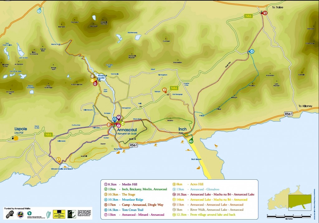
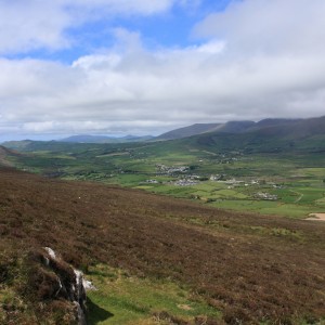
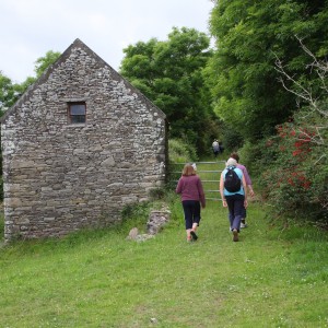
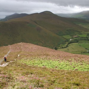
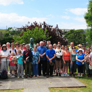
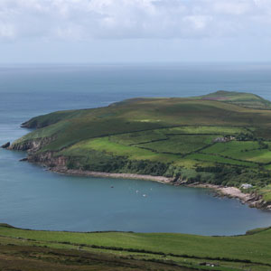
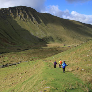
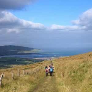
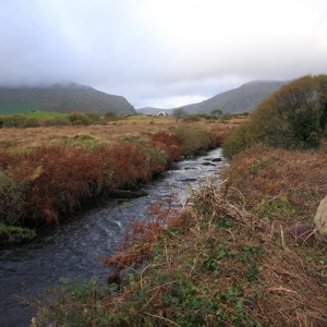
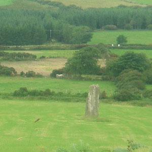
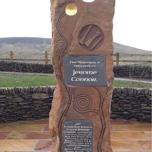
The sculptor Jerome Connor was born in Com Dubh in 1876 among his famous works are the Luisitania Memorial Cobh, Robert Emmett Dublin, Walt Whitman Memorial Washington D.C. This trail starts at the Jerome Connor memorial on the N86 where you have a panoramic view of the hills and landscape surrounding Jerome’s birthplace.  The trail then takes the Ballyandreen exit off the N86 following the winding road to the Stepping Stone crossing over the river. Continuing on the secluded road to Com Dubh passing the plaque marking his birthplace. The walk finishes at the village with the Jerome Connor Garden and Gallery.

Start: Jerome Connor Memorial on the N86.

Distance: 10 Km.

Rating: Easy

Terrain: Road/River crossing

Time: 3 hours

Brikany

Start: Inch Car park

Distance:  15 Km.

Rating: Moderate

Terrain: Road/Trail/Hill

Time: 5 hours

Share This: